Table of Contents
Introduction to LiDAR
Industry Applications for Drone LiDAR Mapping
Cost Considerations for Drone LiDAR Mapping
Choosing the Right Drone and Sensor for LiDAR Mapping
Operational Guidelines and Best Practices
Introduction to LiDAR
LiDAR, or Light Detection and Ranging, is a cutting-edge remote sensing technology that measures distance by illuminating a target with laser light and analyzing the reflected pulses.
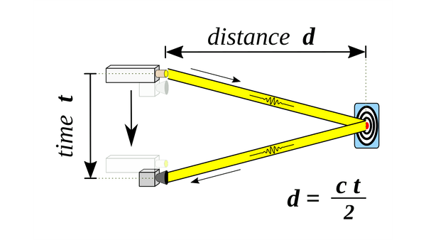
The core principle of LiDAR sensor is straightforward yet powerful: it emits thousands of laser pulses per second, each bouncing back to the sensor, which measures the time each pulse takes to return. This data is then used to calculate precise distances, forming a complex and accurate three-dimensional representation of the scanned area.
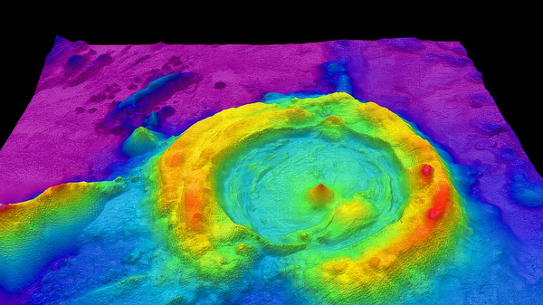
What does this mean in context? LiDAR is able to penetrate dense vegetation and reveal the true topography of the land beneath. This becomes crucial for various applications, as it provides accurate data about ground surfaces that are otherwise obscured by dense foliage.
Drone LiDAR vs. Photogrammetry
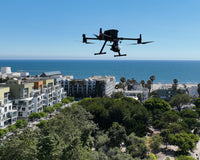
The integration of LiDAR technology with drones has transformed the landscape of aerial mapping and surveying. Drones equipped with LiDAR sensors take advantage of the agility and mobility of uncrewed aerial vehicles (UAVs) to capture high-resolution data across extensive and often challenging terrains.
This combination offers significant advantages over traditional surveying methods, particularly with accessibility and efficiency. Drones can reach areas that are otherwise inaccessible or hazardous for humans, and can cover large expanses of land quickly, reducing the time and labor costs associated with ground-based surveying methods.
One key output from drone LiDAR mapping is the creation of detailed 3D maps and models. These models provide a wealth of information and are far more detailed than those produced by traditional photogrammetry methods.
Photogrammetry, which relies on photographs to gauge depths and dimensions, can be limited by lighting conditions and visual obstructions. In contrast, LiDAR mapping is not impeded by these limitations as it uses laser light to penetrate vegetation and capture ground surface details with high precision.
Industry Applications for Drone LiDAR Mapping
Surveying and Construction
Drone LiDAR mapping is a game-changer in the surveying and construction industry, providing a level of detail and efficiency unmatched by traditional methods. When developers are interested in a piece of land, understanding its topography is crucial for planning and budgeting. LiDAR allows them to see through dense vegetation and assess the land's contours and features. This information is critical for determining the amount of earthwork needed, the feasibility of redirecting water flows, and the overall complexity of preparing the site for construction.
For instance, when planning a new subdivision, developers can use LiDAR data to make informed decisions about where to place buildings, roads, and drainage systems, ensuring optimal land use. The precision of LiDAR allows for accurate budgeting and timeline estimation, reducing the risk of unexpected costs and delays during the construction process.
Conservation and Forestry

Monitoring the natural water cycle is vital in conservation and forestry, especially the context of a national park.
High water levels in ponds and lakes can lead to overflow and unintended water drainage, potentially causing ecological disruption or flooding. Drone LiDAR mapping provides a detailed view of the land's topography, enabling park managers to track and manage water flow effectively.
By analyzing LiDAR data, they can identify areas at risk of flooding and take preventative measures, such as reshaping the land to facilitate water drainage. The ability to penetrate tree cover with LiDAR reveals detailed land contours, helping with planning conservation efforts and infrastructure development within the park.
Utility and Power Lines
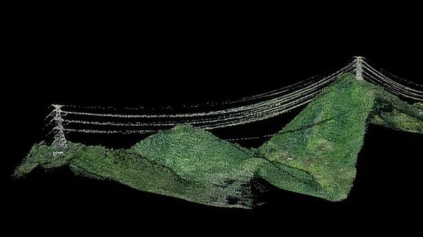
Utility companies increasingly rely on drone LiDAR mapping to manage and maintain power line infrastructure. In heavily forested areas, tree branches can threaten the safety and reliability of power lines.
LiDAR-equipped drones provide a comprehensive view of the vegetation around power lines, helping utility workers identify areas where trimming is needed. This preventive maintenance is essential for reducing the risk of power outages and ensuring the integrity of the electrical grid.
Furthermore, LiDAR data can assist in planning new power line installations, allowing engineers to design routes that minimize environmental impact and reduce the need for future vegetation management.
Agriculture
Drone LiDAR mapping transforms how farmers and agricultural managers understand and utilize their land. One use case for LiDAR is locating wild rice or specific crops in vast, dense areas.
LiDAR can also output detailed maps highlighting variations in plant height and density, helping identify crop locations efficiently. This level of detail supports better crop management, from planning harvests to optimizing irrigation systems. By understanding the precise topography of their land, farmers can also implement more effective soil conservation techniques, reducing erosion and enhancing productivity.
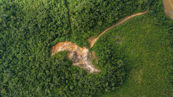
Archaeology

In archaeology, uncovering the secrets of the past can often require navigating through dense vegetation and challenging landscapes. Drone LiDAR mapping has become an invaluable tool for archaeologists, allowing them to explore and map ancient sites without disturbing the ecosystem.
This non-invasive approach is particularly beneficial in areas like jungles, where traditional excavation methods are complex and destructive. LiDAR can reveal the topography of land hidden under thick foliage, exposing the outlines of ancient structures and settlements, such as the Mayan ruins. This technology accelerates archaeological discoveries and helps preserve the integrity of these historical sites for future study and exploration.
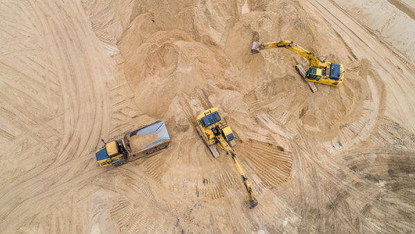
Mining
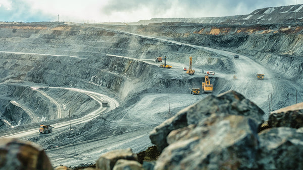
In the mining sector, LiDAR mapping facilitates more than just routine operations; it enhances safety and efficiency across various activities. Monitoring stockpile volumes with LiDAR ensures accurate inventory management, which is crucial for operational planning and financial forecasting.
Mine site safety inspections are also more effective with LiDAR data, which can identify potential hazards like unstable slopes or pit walls. This proactive approach to mine safety can prevent accidents and improve the overall sustainability of mining operations.
Cost Considerations for Drone LiDAR Mapping
Initial Hardware Investment
Drone and LiDAR Sensor
The primary expense in a drone LiDAR setup is the drone itself and the LiDAR sensor. Prices vary widely based on the drone's capabilities, the sophistication of the LiDAR sensor, and the integration between the two. Entry-level systems cost a few thousand dollars, while advanced setups could run into hundreds of thousands.
Software and Data Processing
Data Processing Software
LiDAR data processing software can vary in cost. Some platforms offer essential features for free, while others charge for more advanced processing capabilities. The choice of software should align with the project's needs and the details required for the data analysis.
Training and Licensing
Depending on the complexity of the software and hardware, training for team members and licensing fees for the software may also need to be considered.
Operational Costs
Flight Ops
Operational costs include pilot expenses, flight planning, and on-site logistics. These costs can vary depending on the mapping projects' location, duration, and complexity.
Maintenance and Repairs
Regular maintenance is essential to keep the drone and LiDAR sensor in optimal condition, and maintenance costs should be factored in for wear and tear or accidental damage.
Regulatory and Administrative Costs
Insurance
Insuring the drone and LiDAR equipment against damage or loss is a wise investment to protect against unforeseen circumstances.
Certifications and Permits
Operating a drone for commercial purposes requires specific certifications, like a Part 107 and certain areas may need permits for aerial surveying, which can add to the overall cost.
Considerations for Return on Investment (ROI)
Project Scale and Frequency
The scale and regularity of planned LiDAR mapping projects should be considered when evaluating the ROI. A higher upfront investment in more capable equipment can be justified if it will be used frequently and for large-scale projects.
Data Value
The value of the data and the insights it provides to clients or stakeholders play a critical role in justifying the cost. High-quality, accurate data can lead to better decision-making in various fields, potentially opening new revenue streams or saving costs in other areas.
Choosing the Right Drone and Sensor for LiDAR Mapping
Terrain and Mission Requirements
Terrain Adaptability
The shape of the area to be surveyed, whether flat, rocky, or hilly, plays a significant role in drone selection. Multicopter drones are maneuverable and suitable for complex terrains with vertical structures or uneven landscapes. Conversely, fixed-wing drones are ideal for large, flat expanses but require more space for takeoff and landing unless opting for a Vertical Takeoff and Landing (VTOL) model.
Survey Area and Flight Duration
The size and topography of the target area dictate the drone's required flight time and speed. High-speed drones, such as fixed-wing or helicopter models, are preferable for extensive, flat terrains because they efficiently cover large areas. Multicopters, although slower, are suitable for smaller, more detailed surveys.
Technical Specifications
Autonomy and Battery Life
The drone's autonomy, influenced by its battery life, determines how much area can be covered in a single flight. Fixed-wing drones typically offer longer flight times than multirotors, making them more suitable for extensive survey areas.
Altitude and Field of View (FOV)
The drone's operational altitude and FOV affect the coverage area and data resolution. Higher altitudes provide broader coverage but may reduce the LiDAR point cloud's detail. Optimal mission planning balances these factors to achieve the best results.
Payload and Sensor Performance
Payload Capacity
Ensure the drone can carry the LiDAR system, including all necessary components, without compromising flight stability and safety. The drone's lifting power must match the weight of the LiDAR hardware to ensure efficient data acquisition.
Vegetation Height Consideration
In areas with tall vegetation, the drone and LiDAR system should operate at an altitude, providing a safe clearance above the canopy, ensuring unobstructed data collection and flight safety.
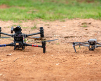
Drone Platform Options

Multirotor Drones
Offers flexibility and precision in navigation, ideal for detailed surveys in challenging terrains.
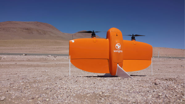
Fixed-wing Drones
Provide efficiency and extended coverage, suitable for large-scale, linear surveys.
Helicopter Drones
Combine agility and payload capacity, which is best for extensive surveys requiring substantial LiDAR equipment.
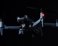
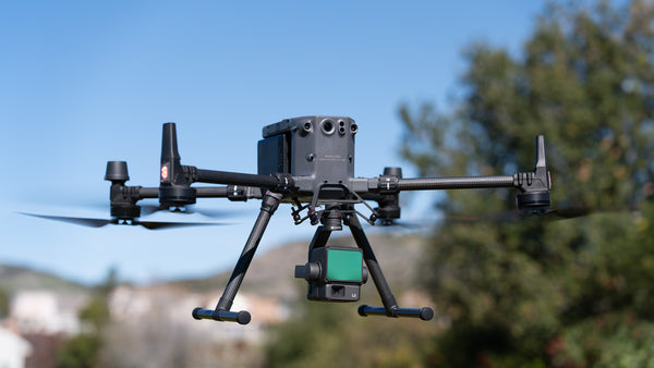
Advexure's Top Pick: DJI Matrice 350 RTK with Zenmuse L2 LiDAR Sensor
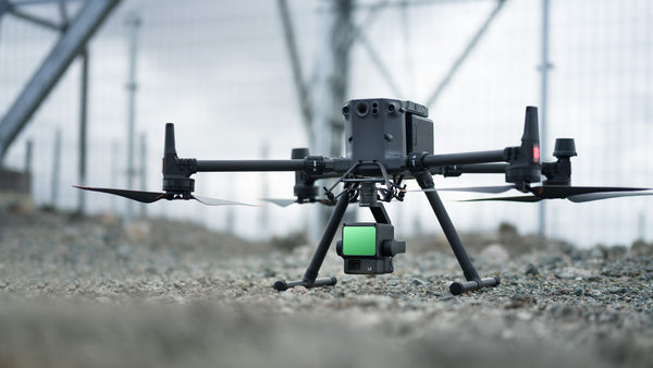
For a balanced solution that offers advanced navigation, significant payload capacity, and integrated LiDAR technology, Advexure recommends the DJI Matrice 350 RTK with the Zenmuse L2 LiDAR sensor. This setup is ideal for various applications, providing the flexibility to cover diverse terrains and survey requirements while ensuring high-quality data collection and operational reliability.
Operational Guidelines and Best Practices
1. Legal and Pre-Flight Preparations
Before starting drone LiDAR operations, specific regulatory and safety steps must be taken to ensure safe and compliant flights.
- Part 107 Certification: The Remote Pilot in Command (RPIC) must obtain a Part 107 certification, which involves passing an aeronautical knowledge test. This certification is crucial for conducting commercial drone operations legally in the United States.
- Airspace Assessment: It’s important to check the airspace where the drone operations are planned. The RPIC should use tools like the FAA's B4UFLY, Air Aware, or other airspace management platforms to identify any airspace restrictions or requirements.
- NOTAMs and Temporary Flight Restrictions (TFRs): Be aware of Notices to Airmen (NOTAMs) and TFRs that may affect the planned flight operations. These notices provide information about temporary changes to airspace usage and can indicate areas to avoid due to events, emergencies, or other airspace activities.
- Safety and Risk Assessment: Conduct a thorough safety and risk assessment for the planned LiDAR survey. This includes evaluating potential hazards on the construction site and surrounding area and planning how to mitigate these risks during your operations.
2. Flight Planning and Execution
- Flight Path Planning: Careful planning of the drone's flight path is essential to ensure comprehensive coverage of the construction site. Consider the terrain and potential obstacles to optimize the flight route and capture all necessary data.
- Flight Altitude and Overlap Strategy: Generally, flying at an altitude of about 100 feet with a side overlap of 25 feet is recommended for optimal data collection. The overlap strategy, whether single, triple, or repetitive passes, depends on the project's specific requirements and the desired resolution of the LiDAR data. The size, model, and endurance of the drone is also a factor in determining your flight path.
3. Calibration and Settings Adjustment
- LiDAR Sensor Calibration: Before each flight, calibrate the LiDAR sensor to ensure its settings are optimized for the environment and project needs. This calibration helps in capturing accurate and high-quality data.
- Performance Optimization: Adjust the drone and LiDAR sensor settings according to the day's specific conditions, such as light levels and weather, to maintain optimal performance throughout the data collection process.
4. Data Processing
- Data Processing with Specialized Software: Use specialized software like DJI Terra to process the collected LiDAR data. This software is designed to create accurate and detailed 3D models from the LiDAR data, which are essential for planning and analysis.
- Software Compatibility: Understand that each LiDAR sensor may have proprietary software to process data into usable formats like LAS (LASer) or LAZ files. For instance, for DJI drones, you will need to use DJI Terra to generate your LAS file. The file can then be used in AutoCAD or other surveying drafting programs.
Need Help? Have Questions?
Drone LiDAR mapping revolutionizes data collection across industries, offering precision, efficiency, and cost savings. As you consider integrating this technology into your operations, Advexure is here to help.
Our team of Part 107 certified pilots and industry experts can guide you through the process and ensure you maximize the benefits of UAS technology. Contact Advexure today to explore how drone LiDAR can enhance your commercial and enterprise projects.